


About US
The GIS Research Center, established in April 2001, provides research findings through a scientific integration and analysis of a wide range of geographical phenomena and activities. The center seeks to initiate and facilitate research on modern spatial information technologies and their applied role in national projects and industries, with emphasis on innovative methods to acquire, build and utilize geographical information. To this end, the center endeavors to draw upon expertise from information technologies, civil engineering, environmental engineering and a variety of other fields that pursue information-oriented problem-solving in areas such as transportation, management and e-commerce. While provided to government and business, this information is also proliferated through a variety of communication and training initiatives.
Research Areas
[ MANAGEMENT AND POLICY-MAKING BASED ON GEOGRAPHIC INFORMATION ]
- Applying geographical analysis to urban management and decision-making processes such as urban planning, transportation planning, environmental planning, growth management, commercial impact analysis, site selection, and disaster management
- Developing integrated and interdisciplinary decision-making methodologies using computer-enhanced statistical, mathematical and engineering techniques
[ ACQUIRING SPATIAL DATA AND DESIGNING GEOGRAPHIC DATABASE ]
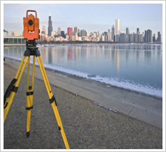
- Establishing and utilizing the national geodetic network
- Constructing and standardizing the geographic database
- Acquiring remotely sensed data and creating digital maps
- Acquiring geographic data through GPS and developing applications
- Developing innovative surveying techniques (i.e. GPS, RS, GIS)
[ Performing Applied Research and Cooperating in Neighboring Areas ]
- GIS techniques and IT fields
- Urban planning information systems (UPIS) and land use information systems
- Environment management systems, Natural hazards and disaster management systems
- Intelligent transportation systems (ITS), Mobile-GIS, Logistics, CALS-GIS
- Web-based GIS for local information and e-commerce
[ Construction and Evaluating Geographic Information Systems ]
- National Geographic Information Systems (NGIS)
- Parcel-based land Information Systems (PBUS, LMIS)
- Establishing and evaluating GIS-related master plans of local governments
- Supervising GIS-related projects
[ Providing Related Education and Communication ]
Training experts for central or local governments and industries Communicating with domestic and foreign countries and institutes Holding GIS-related seminars and conferences
Recent Activities
- iMars : Analysis of Mars Multi-Resolution Images using Auto-Coregistration, Data Mining &Crowd Source Techniques
- Development of a Coordinate System for Stratigraphic Information Integration and Visualization
- Development of a cloud-based total station survey solution
- Global Applications of Low Carbon and Green Growth Urban Development and Management
- Developing a dynamic evacuation guidance system based on indoor sensor
- Development of Tightly Coupled GNSS/Vision/On-board vehicle Sensor Positioning Algorithm
- Development of Multi-sensor based Car Position and Attitude Determination System for Low Cost MMS
- Development of Multi-sensor Based Spatio-temporal Monitoring System for Magma Activity Observation under Mt. Baekdu Volcano
- Development of data fusion algorithms for value-added products
Faculty
- Prof. June-Hwan Koh / GIS, UIS, Urban Planning
- Prof. Chulmin Jun / Spatial Database, Spatial Analysis
- Prof. Yun-Soo Choi / Surveying, Geomatics Engineering
- Prof. Impyeong Lee / Photogrammetry, Computer Vision, LiDAR
- Prof. Seong-Kil Cho / GIS-T, Transportation Planning
- Prof. Jay-Hyoun Kwon / Geodesy, GNSS, MultiSensor Integration
- Prof. Jiyeong Lee / 3D GIS, Spatial Data Models
- Prof. Hyung-Sup Jung / Remote Sensing, InSAR