


About us
The center aims to develop multi-disciplinary solutions for more convenient, secure, and efficient uses of unmanned vehicles particularly in a metropolitan area such as Seoul. In future, we expect that lots of self-driving cars move on the streets and huge number of drones fly in the air even in complex metropolitan areas of high buildings and many peoples. Are we or actually, is our city ready for this situation? Maybe not! We have to be prepared. We derive any possible issues or problems in terms of law and regulation as well as technology, and develop appropriate solutions in advance by performing multi-disciplinary projects with industries, national research institutes, and local and central governments. The solution is validated in a test-bed established inside Seoul, and expanded to other metropolitan cities.
Research Areas
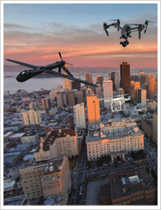
[ UNMANNED AIR SYSTEMS (UAS) ]
Mapping and Remote Sensing Using UAV Multi-sensor Systems Sensor Integration & Data Processing for UAV Applications UAV Based Real-time Monitoring / Rapid Mapping for Surveillance & Disaster Monitoring Autonomous Control & Avoidance Based on Sensor & Geo-spatial Data Fusion Precise Determination of UAV Positions & Ground Monitoring Systems AI Based Drone Control and Data Processing & Analysis
SELF-DRIVING CARS High-resolution Road Maps for Self-driving Cars Using Mobile Mapping Systems Low-cost Precise Determination of Vehicle Positions Using Sensor & Geo-spatial Data IoT & V2X Based Intelligent Transportation Systems for Self-Driving Cars
[ OTHER UNMANNED VEHICLES (UV) ]
Applications Using Unmanned Ground / Surface / Underwater Vehicles (UGV, USV, UUV) Development of Indoor Unmanned Vehicle System and their Applications
[ LAW, REGULATION & POLICY DEVELOPMENT ]
Law & Regulation Related to Unmanned Vehicles Particularly for Metropolitan Areas Policy Development Related to UV Applications & Promotion for Local / Central Government
[ TRAINING & ACCREDITATION ]
Development of Training Curriculums, Manuals and Facilities Accreditation of Drone, Drone Mapping System, and Drone Based Applications
Recent Activities
[UAV Mapping & Applications]
-Activation Planning of UAV Utilization for Seoul Metropolitan Government (2016)
-Marine Surveillance Network: UAV Based Approach (2015-2019) -Open Source Geospatial Software for UAV Mapping (2014-2017)
-Monitoring Water Nearby Infrastructure (2014-2018)
-Small UAV Based One Stop Rapid Mapping System (2012-2014)
-UAV-Based Real-time Aerial Monitoring System (2007-2012)
[Self-Driving Cars / Mobile Mapping System & Contents]
-Simultaneous and Precise Determination of Multiple Vehicle Positions through Fusion of Spatial Information and Multi-sensors and V2X Based Network Adjustment (2017-2020)
-Image Based Car Navigation using Multi-sensory and Road Data (2012-2016)
-Indoor 3D Modeling and User interaction Techniques Using Stereo Omni-directional Images (2013-2016)
-Safety Upgrade of Inner Space Using CCTV Camera Simulation (2013-2014)
-Interactive 3D Stereo Contents for Indoor LBS Services (2010-2012)
-3D Stereo Omni-directional Camera System (2010-2012)
[Sensor Simulation, Processing, and Applications]
-LADAR Simulator (2007-2012)
-3D LADAR Image Processing Techniques (Simulation, Processing and Target Detection) (2010-2013)
-Fusion of LIDAR and SAR for Forest Biomass Estimation (2009-2012)
-Automatic Generation of 3D Building Models based on Fusion of Airborne LIDAR Data and a Digital Map (2007-2008)
Faculty
Impyeong Lee – UAV Mapping / Photogrammetry / Computer Vision / Remote Sensing
Hyung Sup Jung – Remote Sensing / InSAR
Soojin Cho – Infrastructure Monitoring / Sensor / Civil Engineering
Jaedong Choi – Applications in Defense / Mathematics
Kyoungah Choi - UAV Mapping / Photogrammetry / Computer Vision